Showing posts with label Argentina. Show all posts

August 13, 2012

South America - Argentina Mendoza, Land of Sun and good Wine

Somehow or rather, even though the lake region was highly recommended and popular among Argentinean or in South America, I was not that impressed. I guess after the wonderful times in the Penguin Land, End of the World and the Glaciers, the lake region seems a bit plain except Puerto Varas was nice and quiet.

At such, I was having high hope for Mendoza.

I took a night bus from Bariloche to Mendoza, 20 hours. Any bus rides in Argentina are around that long. At Bariloche bus terminal, a bottle of mineral water cost 5 peso for 500ml and 15 peso for 1500ml. Also, two small Cadbury cost 15 peso, the most expensive I ever seen. Sometimes, it also depends on the colour of my face, not just the farang has to pay more in the east but the chica also has to pay more in the west, same theory.
The bus was very comfortable, but I just couldn't sleep.  I no longer can sleep on night bus or train, I just need a comfy bed.

Mendoza is called the Malbec Land, not surprisingly why. It produces 80% of Argentinean grapes, thus, Argentine wines. And that 80% are consumed in Argentina alone. It shows how much Argentinean likes to drink. Most the wines here are German in heritage, strong fermentation and lot of yeast smell, not exactly my taste but that is how Argentinean like it.
With the wine, Mendoza becomes a party town at night. Visitors love it here but it is noisy to me.
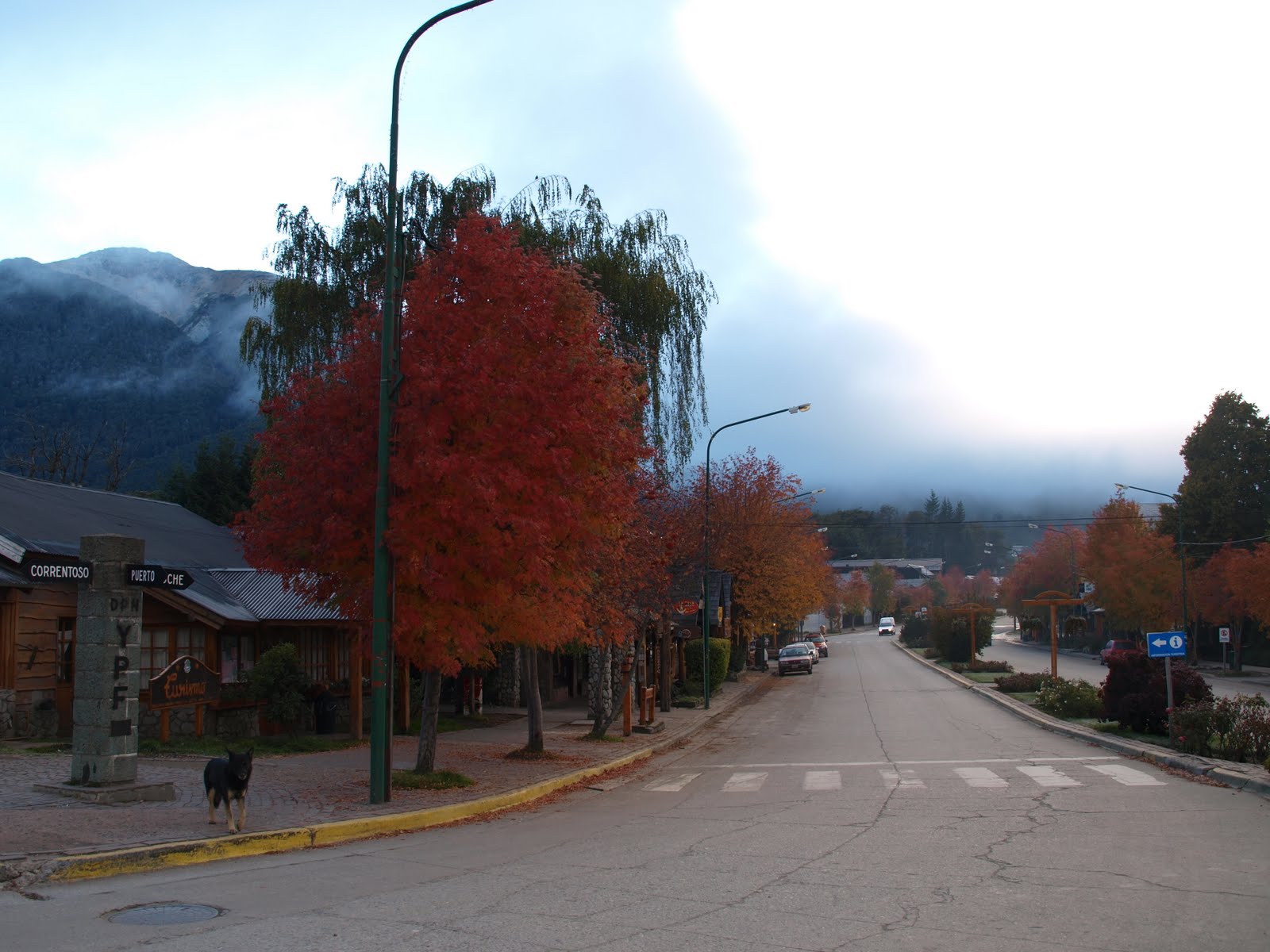
However, if you take the time to walk the street in the morning, Mendoza is a beautiful 'suburb' with the grid concept. Every house is a little bungalow, with a little porch and a little garden. It is just a perfect pictureque, very livable city.

The down side for me was I had two, not one, bad hostel experience here. The Dama Juana hostel screwed up my booking and pretentious on their innocence and the Itaka hostel was filthy dirty with a smelly bathroom. The screw up in the Dama Juana hostel spoiled the day, however, I didn't really like the wine anyway. As Mendoza is turning into a party town, foreign visitors especially the young group is dominating the scene.

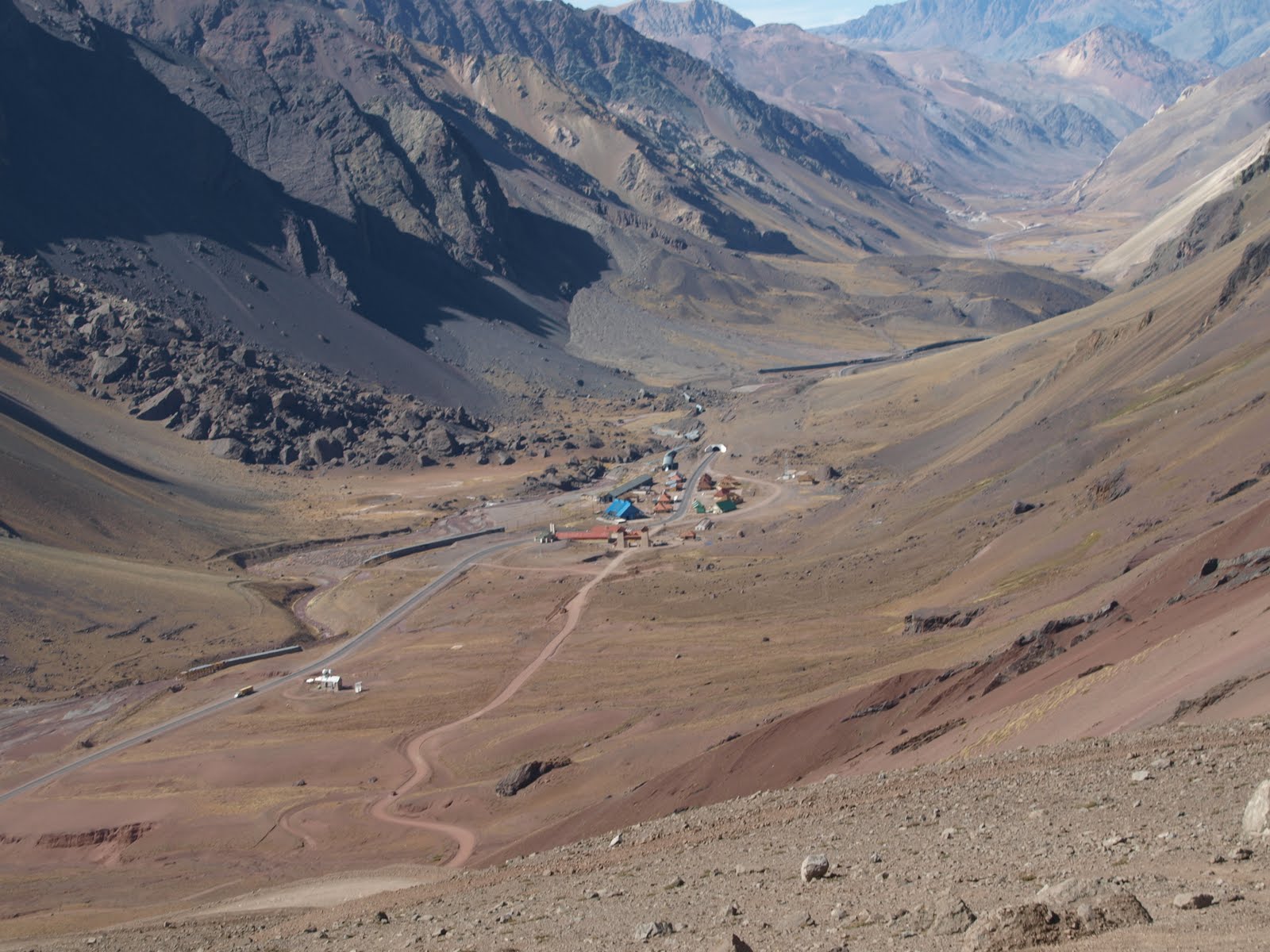
The next day or so I had taken a Montana Tour. I had visited the Aconcagua National Park, the little bit left over of the ancient Inka bridge and the old Pass for crossing to Chile.
Mt. Aconcagua (with a hanging Moon), Argentina - Apr 2010.
The Old Pass at 4000M
The New Border Custom


Nothing impressive, I seen higher and prettier mountain, I had later went over higher Pass at 5200M in Bolivia and trekked the 'real' Inka Trail in Peru. Save your money and drink more wine.

Beautiful Art Pieces, Argentina - Apr, 2010.
For all that I don't like about this place, I saw these beautiful art pieces in the little bazaar we passed by to see the Inka bridge.  I got myself 3 pieces to bring home.

The day after, accidentally, I went to the Cacheuta thermal bath by public bus and into the public thermal pool.  This act saved me lot of money and enjoyed the thermal bath with the regular Argentinean, which I thought was the most fantastic time I had in Mendoza.

I left Mendoza on the Labour Day, feeling the un-necessary 4 days stop over, and promised myself I shall not be back. The bus took me on the same journey as the Montana tour but this time I was crossing to Chile and heading to Santiago.

July 21, 2012

South America - Argentina Bariloche, the Seven Lakes road

May it be conincidence, but may be not!
As I almost get to the moment to write about the Seven Lakes road, Jean put The Motorcycle Diaries in front of me and said, a good book to read. It is indeed a good book to read.

Surprisingly, without knowing it, I made the same route just like Ernesto CHE Guevara. The Seven Lakes road was undertaken in the book during the February of 1952.  If you keen to visit Argentina and Chile, you will come to know that "The Lake Region" in these two countries is one of the most scenic region in the countries.  The road, over Argentina side, simply pass by seven lakes and going through towns from San Martin de los Andes, Villa la Angostura to San Carlos de Bariloche. 
You may continue this journey further to Chile though a combination of cruises and rides with multiple lake crossing.  Along this journey, you will see the Isla Victoria, Bosque de Arrayanes,  Peulla waterfall and Osorno volcano from the east where you will reach either Puerto Montt or Puerto Varas.  From here, you actually can take a bus by land road back to San Martin or Bariloche through the towns of Frutillar, Osorno and the Puyehue National Park, making a full circuit of loop.

That is what exactly I done. I went to San Martin and hiked up the mountain, the small is just as described come into full view.
San Martin de los Andes, Argentina - Apr, 2010.
Going back to Bariloche, I passed by Angostura.
Villa la Angostura, Argentina - Apr, 2010.
And of course, I would not be missing the Seven Lakes on the Seven Lakes road.
7 Lakes View, Argentina - Apr 2010.

Hosteria 7 Lagos
7 Lakes View

June 25, 2012

South America - Argentina Bariloche, Switzerland another

I have never been to Switzerland, not qualified in saying which  or what is the same.  But for all the Brazilian and Argentinean who came here to enjoy the weather, which was a lot, they thought so.
San Carlos de Bariloche, or short name as Bariloche, got its name from Vuriloche meaning "people from behind the mountain".  This city has all the elements like Switzerland - the architectural development, the alpine, the ski resorts, the St.Bernard dogs and the chocolate.  Yes, even the chocolate! The Bariloche chocolate is especially famous for Argentinean who loves sweet.

For all that, there are two things I would like to remember Bariloche for - the meat and the lake!
Why the meat? It is because I never had so much meat in my life than at Bariloche. For every city that I travelled 3-4 days, I normally will ask the hostal to recommend a nice restaurant to have at least one nice meal for the city.  And in Bariloche, I went to Familia Weiss, a restaurant famous for its vension and trout.  The setting was warming.
Table setting in Familia Weiss, Bariloche
Argentina, Apr 2010.

I was quite ignorant still, at that time, of the size of serving for a meal of meat.  I ordered a lamb steak and it turned out, in my opinion, to be able to serve a whole family.
Lamb steak in Familia Weiss, Bariloche
Argentina, Apr 2010.
There were at least 8oz of meat here.  And there and then, I finally understood what meant by my Argentinean friend that they eat a lot of meat.  The food there was delicious.  The salad I ordered is called Summer Holiday, even though it was almost winter already when I visited.
Salad Summer Holiday in Familia Weiss, Bariloche
Argentina, Apr 2010.
It was the best salad ever I have had.  Avocado, strawberry, mandarine oranges and vine tomatoes made up a Summer Holiday.
Another reason why I have to talk about Familia Weiss, is the service.  While I had very good food in Buenos Aires and Ushuaia, the service there had not made me felt the warm welcoming feeling. While in Familia Weiss, they treated me as every other customer who came to Bariloche for a nice holiday.  They drew people back to Bariloche.

Bariloche is on the southern shore of Nahuel Huapi Lake surrounded by Nahuel Huapi National Park.  The region it is within is called the Lake District for both Argentina and Chile.  The famous "Seven Lakes Route" will take you from Bariloche to San Martin on a beautiful journey. While another lake crossing journey from Bariloche to Puerto Varas in Chile will take you on a 7 cruises plus multiple bus transfers journey, allows you to see the amazing Osorno Volcano on the way.

June 21, 2012

South America - Argentina Nahuel Huapi, Why is it Black not Blue?

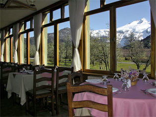
We went to Hosteria Pampa Linda for lunch.  It is a gorgeous place. I and Sarah had a table next to the window, with an open view to the Cerro Tronador.
From http://www.hosteriapampalinda.com.ar/english/servicios-pampa-linda.html#restaurante
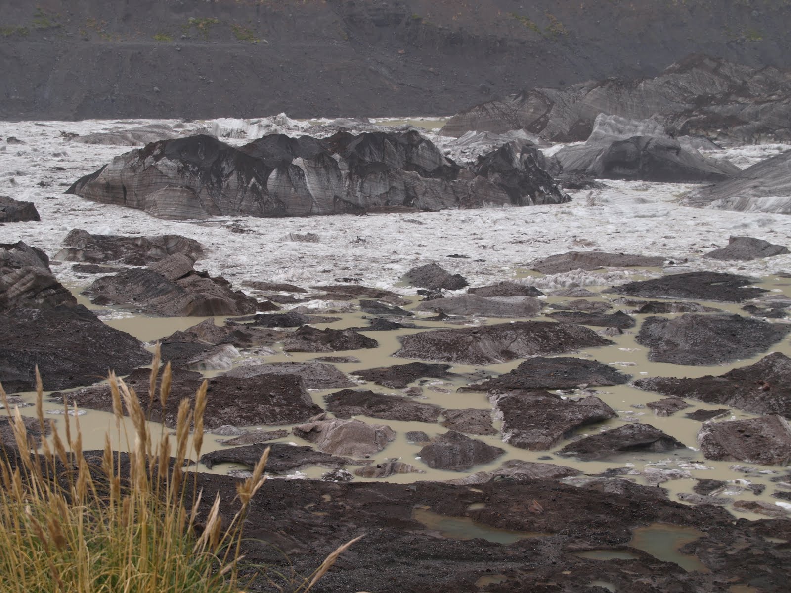
The lunch was authentic pumpkin soup, my favourite. I felt much better after a home-make lunch, and recovered from the fatigue and all the restless days.  Sarah was staying here for a couple of days to hike around.  The guide came here to drop her, and the rest of us continued the afternoon to see the relic Black Glacier.  The Black Glacier name is Ventisquero Negro.
Ventisquero Negro, Nahuel Huapi National Park
Argentina, Apr 2010.
Feeding by the ice from the summit of Cerro Tronador, the Black Glacier becomes a huge mass of ice dragging every sediment and mineral along the way sliding down the peak, making it one of the biggest icer tounges around.  The process of melting and freezing is making its composition possible through crystallization of mineral and ice.
Ventisquero Negro, Nahuel Huapi National Park
Argentina, Apr 2010.
Ventisquero Negro, Nahuel Huapi National Park
Argentina, Apr 2010.
The layers in the ice represents the years of crystallization.  Thus, the age of the icer tounge is told by the line in the ice. Similar to the way we look at the age of a tree, the circular line in the log of a lumber is the age of the tree.  In the case below, a very icer tounge had broken off.
Ventisquero Negro, Nahuel Huapi National Park
Argentina, Apr 2010.
As much as we would not want it to happen, the sign of global warming is clearly seen here.  The glacier becomes smaller when its icer tounge broke off and flowed away.
Ventisquero Negro, Nahuel Huapi National Park
Argentina, Apr 2010.
The guide was right! It did take a rainy day without sun to see something as unique as the Black Glacier.

I was tired without word when I was back to the hostal.  Thus, I demanded, for the first time in the journey, to have a room changed and the heater turn on. I slept straight through the night till late morning the next day.

June 17, 2012

South America - Argentina Nahuel Huapi, Journey to the Black Glacier

I spent a week from trekking Glaciar Perito Moreno to Los Torres del Paine, finishing 1st leg of the journey in 3 weeks.  Subsequently, it was all road trips, 5 hours evening bus from Torres del Paine to El Calafate. A tiring night with a next day flight and another ride, then I arrived Bariloche which is called 'Switzerland of Argentina'.

Exhausted with fatigue, I was pretty unlucky the 1st night to have a dorm-mate who snored ever loudest and it was a hostal that seemed to forget to turn on the heater.  It was freezing cold and I hardly slept.  Without proper rest, I was up early at 4am while the trip to the Nahuel Huapi National Park starting at 7am.

Nahuel Huapi National Park is no strange subject to any Argentinean.  The oldest national park in the country, with the national hero Francisco Moreno donated 75 square kilometres (29 sq mi) of land in the area to the federal government in 1903, Nahuel Huapi is nearly 2 Million Acres in size and surrounds Nahuel Huapi Lake.  In the famous Mapuche language, Nahuel Huapi means 'Jaguar Island'.

My guide is a German descendent.  It seems the population around the lake region in both Argentina and Chile are mainly German descendent. Off we went to pick up a full van of Brazilian (Brazilian loves to visit Bariloche till Argentinean deem Bariloche as Braziloche), and another British navy, Sarah.  As we entered the national park, I noticed that the wall of some of the mountain had marks left by glacier movement.
Nahuel Huapi National Park - Argetntina, Apr 2010.
It shows the ice age of the earth. As our van passed one part of the forest, I saw a hollow pathway through the wood.  It seemed like a tunnel which swept by some heavy objects through the forest.
Nahuel Huapi National Park - Argetntina, Apr 2010.
I asked the guide why the national park just swept and made path like that, and the guide said "It was not us, it was the ice!"  Apparently, this happened almost every spring.  After winter, the water in the mountain built up the ice.  When the ice started to melt in spring, it started to move, then down the hill, sweeping everything along with it!  The guide told me as he comes to the park almost every other day, it happened once the ice was moving down hill and passed right in front of his van, making a sound that he will never forget.  Judging from the photo, the force was tremendous!

We arrived the vista point at the Nahuel Huapi Lake, where we saw the snow capped Cerro Tronador from a distant.
Cerro Tronador, Nahuel Huapi National Park
Argetntina, Apr 2010.
The national park is in the Patagonia Andean Zone, the Altoandino which above 1600 meters will be perpetually covered by snow. The Valvidian RainForest here (and in Chile) is one of the rare and unique rainforest existed to the area.

As we furthered into the national park, we came to a vista point to view the Piuque Huapi, Piuque means 'Heart' in Mapuche. The Heart (shaped) Island was the cover of the national park brochure.  But, the vista point is not high enough that I was not able to capture the island in a heart shaped. However, I would have to say it is beautiful! 
Piuque Huapi, Nahuel Huapi National Park
Argetntina, Apr 2010.
The morning passed by without the sun, the grey cloud moved in and the sky started to have cold drizzle. I was quite down due to lack of sleep.  As I blared out that may be my luck had run out with good weather, the guide turned, smiled and said to me "No, you are in luck today!" I was thinking "Ya, right!" Then, he continued "We can only see the Black Glacier clearly after the rain, without the sun reflection!"

June 6, 2012

South America - Argentina Los Glaciares, Monte Fitz Roy in Style

Within the Patagonia Ice Field, other than Perito Moreno Glacier, you might find thousands other things intriguing and it is never possible to do it all nor to tell all!
For me in a short trip of 3 months, I always used the top 3 rule.  Thus, this was how the agenda goes - Los Glaciares Nacional Parque, Monte Fitz Roy and Torres del Paine!

After spending my day with Perito Moreno, I also spent another day cruising the Lago Argentino.  The cruise was from 8am-3pm, and it took us out a full route around the lake to see every single other glacier.  Of course, also the Mighty Upsala!

Glaciar Upsala at Lago Argentino - Argentino, Apr 2010.
Ice broken off from Upsala


Sadly, Glaciar Upsala had a huge ice tounge broken off a couple months before my visit causing the cruise couldn't go near it. However, the broken ice tounge did allow us to look inside what is really in a glacier.  Those icy ice are mesmerizing!

The day I was going to El Chalten, I kept telling myself that I am going for the charm!
I don't know why I had that in my mind.
The journey to El Chalten goes along the Lago Viedma. Having another glacier at the backdrop of this lake, making it another nice ride to be with.

El Chalten is located within the national park, thus, living here is bounded by the park's rules. The bus must stop at the park ranger office and we all must get a briefing before entering the town. El Chalten is a nice little town, really little - with only 1 main street, no network, no WiFi. To be connected, it was 12peso/hr, most expensive online I ever did. The passion is burning in the air, as you will not be here if you are not either a hiker, a trekker or a climber. People are the most friendly. So, there is no surprise to see plenty of equipments and people walking by/to the trails. They all look professional, for the very reason.

On the way to the hostel, I saw a little shop - a microbrewery, which I read wrongly that I thought is a place for berry jam. I ended up sitting down for a late lunch. The little eatery is quite international as they have a board full of foreign currency notes - the climbers from all over the world. The waitress did not speak English, but I managed to order an orange juice and a non-cheese non-cream home-make flat pasta (look like our home made pan mee kasar) with tomato cooked with olive oil. The orange juice was so huge, fresh and so nice - it was the first time a fresh squeeze orange juice in the menu. The pasta turned out to be very tasty and it was the best I had in Argentina.

As the wind got stronger and the multiple day activities causing me to be so tire that I headed to bed in no time. Fortunately, the shower was with good hot water!
Waking up the next day as I must do some forms of hiking, the weather was really nice and sunny, no rain and no wind. So, I headed out for the Laguna Capri trail. Laguna Capri trail is the one headed to Monte Fitz Roy, with a very nice view of all the peaks.

I must be the first one headed out since the trail was empty and quiet.  It was a very pleasant hiking trail. An hour later, I saw El Chalten in full view, what a beauty!
El Chalten - Argentina, Apr 2010.
The valley is not deep, may be 200 meters, and the ascending is not steep. It is a well marked trail for even simple hiker or first timer. El Chalten's trails are all friendly trails. It has no sign of dangerous hike, all are with orange markers. Not far, I saw the sign of 10 more minutes to the Laguna Capri signpost. Passing through the forest that started to turn red, in a very short while, I saw Monte Fitz Roy in view.
Monte Fitz Roy - Argentina, Apr 2010.
At that moment as I saw Monte Fitz Roy, I thought in calm that nature set us for a challenge. The straight up and solid granite wall is nothing near but a climber's dream. I am no fanatic climber but a soft hiker. Coming to El Chalten is something at first I thought is a mistake because it felt highly pressurized in the middle of a group of ego climbers.
But, it is a fascinating view as described by the park ranger. It is like you have a painting just raised up right before you. The stunning thing is like it comes out of noway and faces the deep valley. I was just happy and sit there for an hour, staring at the beautiful view and enjoyed my lunch - apple and biscuit! 
The wind seemed to pick up after noon. I got back to the hostel, had a quick meal, and headed right back to my room. Tired and cold, I just sleep! 
Waking up in joy, I went for a walk and back to the park ranger office since I remembered there are 2 short trails, Los Condores and Las Aguilas; going up the opposite direction from the town, with the canyon at the back, in which where the Viedma Glaciar located. The trails turned out to be very steep up around 1000 meters.
The first trail leaded up closed to the highway and can see everything in the town.
The second trail headed to the back and passed a flat plain. There were two folks already up there, sitting by the rock, looking like going to stay for very long just to enjoy the quietness and solitary. I suddenly felt like an outsider. 
It was very windy and cold up there! I also enjoyed the quietness and solitary since the canyon was right before me down 1000 meters. It was looking into the horizon. 
After a while, it was getting too cold with a strong wind so I started my descend. 
I had to catch the 6pm bus back to El Calafate and then, the early 5am bus to go to Torres del Paine! 
The two folks were still sitting there.

June 4, 2012

South America - Argentina Los Glaciares, Trekking the Perito Moreno Glacier

Being in front of the glacier, seeing Perito Moreno ice sheet collapsed, you may think that is pretty satisfying. I thought so, but I was so looking forward for the trekking on the glacier itself.

A group of us was shipped over the opposite side of the Lago Argentino shore, to be exact, we were on the ice!  The feeling was funny, as we knew we were on a 170M thick of ice, then the water, then the bottom of the lake.  We were not floating, but we were, in concept.

First, our guide briefed us on glaciology. Yes, something brand new like that but real interesting.  And if you don't pay attention, you will get scolded by the guide. Ya, I did, got a real lovely serious fellow here :-).
Perito Moreno Glacier - Argentina, Apr 2010.
There is one very interesting fact from glaciology - the colour of the glacier.  Glacier consists of multiple layers of ice, forming from the repetitive process of snow melting and freezing, which results different shades of BLUE!  The reason for the Blue is, surprisingly, the Sun.  The Sun and its reflection on the process making glacier to look the lovely blue colour.
Perito Moreno Glacier - Argentina, Apr 2010.
Then, we were told to put on a pair of crampons. It was the heaviest thing I ever carried by my legs.
Perito Moreno Glacier - Argentina, Apr 2010.
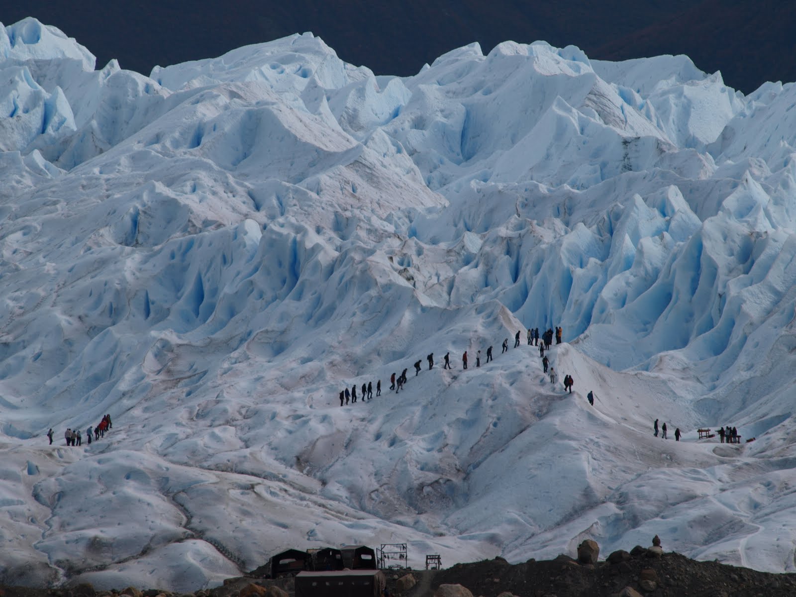
As we started hiking, there was always 1 guide in front - to explain everything and anything around Perito Moreno or the glacier, and another guide at the end back - to protect any trekkers who left behind or got too curious on anything or everything about Perito Moreno or the glacier.  From far view, all the groups will end up forming an "ant queue".
Perito Moreno Glacier - Argentina, Apr 2010.
In which, I thought it is cool and perfect for a picture.
At the end of the trek, all of us were served with the local Perito Moreno specialty in El Calafate - the glacier's ice with whisky!
Perito Moreno Glacier - Argentina, Apr 2010.

June 3, 2012

South America - Argentina Los Glaciares, Crown of the Jewels

I have not heard about Perito Moreno before until 2010 half way through planning my 3 months trip to South America.

When I was hiking in the Parque Nacional Tierra del Fuego, a Spanish couple who had been to El Calafate right before Ushusaia said - you must go, you must see how the glacier ruptures!

There I go, a bus ride that required me to be up at 3am and a stop over at Rio Gallegos.  And 20 hours later, I checked in to the hostel in El Calafate at 11pm. The next morning at 8am, I went straight to the Parque Nacional Los Glaciares. Little that I know I was heading to see one of the most beautiful creations of nature.

Even far from the park, I could spot Perito Moreno Glacier.  Well, that is an advantage to own a SLR lense of 300mm in zoom.
Perito Moreno Glacier - Argentina, Apr 2010.
Perito Moreno is rare, not becuase it is a glacier, but because it is a glacier in a stage of equilibrium.  Alright, you would think what is that mean?  When a glacier is in an equilibrium stage, the glacier is practically, physically growing in size overtime, but also shedding its size over time.  The cycle of growing and shedding created one of the most spectacular scene on earth - glacier rupture event!

The reason for its growth is still a debate in the scientific society.  But the reason it has to shed is because Perito Moreno Glacier sits on the Lago Argentino.  As it grows, it's advances hit the opposite shore eventually.  Its forces clash with the edge of the lake, the pressure built up and creates the rupture that breaks part of its body size and collapses away. The rupture cycle is not regular but naturally depending on the enormous pressure built up. As part of the Patagonia Ice Field in the Southern Ice Sheet, Perito Moreno is not the biggest, Upsala Glacier is, but it is the one which is visible in full fiew from a man-built wooden platform.

I got off the bus, skipping everything, went straight to the viewing platform.  It was late Autumn and almost Winter, it was like the alpine time.  The nicest thing of this national park is, we actually can get really close to the glacier without have to be on the boat.
Perito Moreno Glacier - Argentina, Apr 2010.
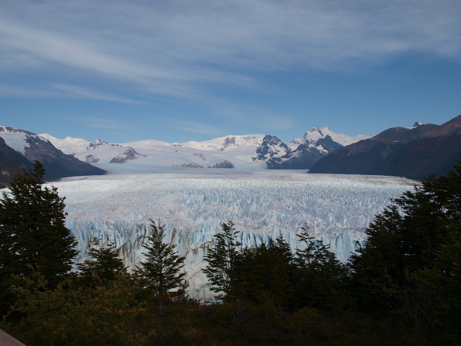
The scene is fantastic! The terminus of Perito Moreno is 5KM wide with 74M hieght above the surface of the lake.
Perito Moreno Glacier - Argentina, Apr 2010.
But it real size hidden beneath the water of Lago Argentino, 170M depth below the surface which is more than double the height from what we see on the water.
I finished the whole wooden platform around for about 2 hours.  Back to the cafeteria, grapped a cup of coffee and headed over to the viewing plaform again.  I was very ready, and stand by to sit for hours to wait for a glacier rupture event.  I got a seat and next to me were 2 Argentinean ladies, senior citizen, who had their sandwiches ready with a polaroid camera - those that with instand photos.  They had been there before me, waiting!

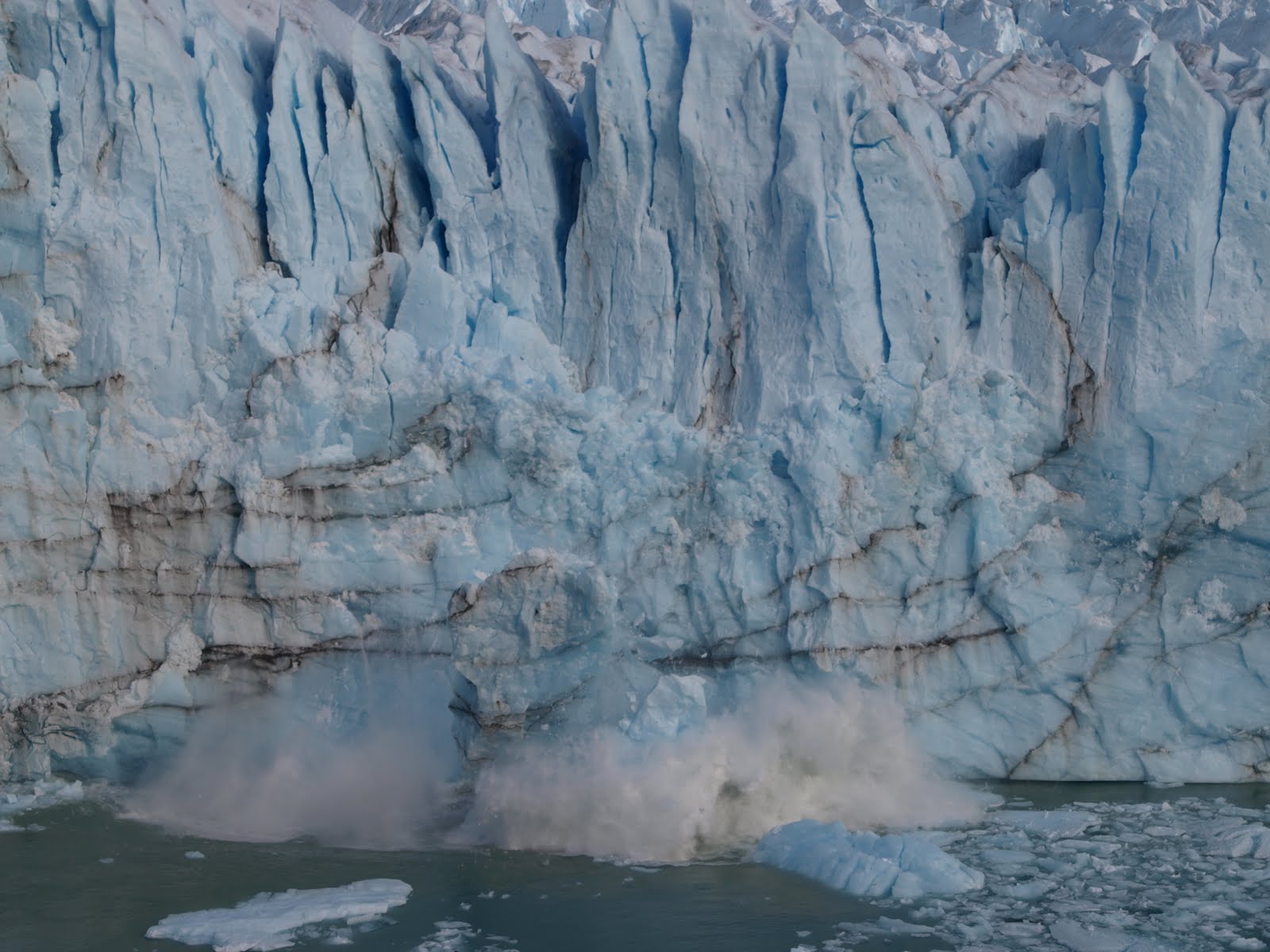
It was silence for at least 30 mins, a long while nothing happened.  Then, they must had felt bored, turned, put down their camera, grapped their sandwiches.  Just as they turned their head and started biting into their sandwiches, my eyes switched to the glacier as I heard a huge tearing sound of splitting - JEAAAAZZZ! I raised my DSLR and instantly pressed the shot which was set in the sequencial shotting mode.  In less than 10 seconds, a huge chunk of the ice sheet falling into the water.
Perito Moreno Glacier - Argentina, Apr 2010.
The 2 old ladies were biting their sandwiches, turned their head back to the glacier, seeing the ice sheet dropping into the Lago Argentino.  They quickly grapped their camera and raised it, but the whole process was over in seconds. Well, they just had to wait somemore for another one.

April 26, 2012

South America - Crossing the Strait of Magellan


Leaving Ushuaia is no easy, mentally and physically.  Physically, I aimed for the bus. The reason is simple - the Strait of Magellan and the Comerson Dolphin.  The bus leaves at 6.30am.  I woke up at 3am, got in very early at 4.30am to the bus station. A bit too early because it was like deserted, nobody there and really really cold! There weren't many using the bus to leave Ushuaia as the bus ride is very long.  Mine, is 16 hours to El Calafate. 

It was good to leave Ushuaia in such a way, quietly in the darkness, so that I would not feel too difficult as I could not see anything around.  I was tired.  The bus came, there were only 2 passengers, me and another lady. I fall asleep right away.  When I woke up, the sun start raising when I peeped through the curtain. It seem to be a bonito morning.
Tierra del Fuego sunrise, Apr 2010.
This tip of our earth, is interestingly shared by Chile and Argentina.  Geographically, Ushuaia faces south on Tierra del Fuego, which makes up by multiple islands but mainly  by Isla Grande Tierra del Fuego.  Leaving Ushuaia and Tierra del Fuego mean the bus goes around to the back of Martial Glacier and headed north,  crossing the Strait of Magellan into the mainland continent. We were still at Isla Tierra del Fuego. It is my 1st crossing to Chile and through the Magallanes.  It is also feel like the real journey start here, as I have been flying and flying never justify things that we want to see in this land.

As the morning passed, yet, this is still Patagonia.  We will not miss the cattle and sheep, while the steppa is a lot more low grown here.
Patagonia sheep herd in Tierra del Fuego, Apr 2010.
It was surprising to see the road condition is not bad, but Patagonia is flat y wide. It took the whole moring to overland the Isla Grande Tierra del Fuego and we reach the point of crossing around noon.
Crossing Point at Strait of Magellan, Apr 2010.
La Isla Tierra del Fuego, Apr 2010
al Estrecho de Magallanes, Apr 2010.
The 1st sign post is the northern end of Isla Tierra del Fuego within the Chilena border and the 2nd sign post is the transborder crossing of al Estrecho de Magallanes (Strait of Magellan) with the main continent.
Ferry Austral Broom for Magellan Strait crossing, Apr 2010.
The waiting was not long. The bus had timed the ride and the ferry came within a short while.  I was told the Strait of Magellan is where the Comerson Dolphin actively flipping.  However, I didn't catch any. The water was as calm as it wanted me to leave my 28 years old dream behind.

April 21, 2012

South America - Argentina End of The World, not The End yet!

I was lucky, from the thought of the earthquake at Chile on 26Feb2010, the 8 hours delay caused by turbulence dented the aircraft wing on 28Mar2010, the luggage didn't get on and off the flight to Trelew on 1stApr2010, to finally comes to the End of The World!

Knowing La Boca like knowing meaningless price tag for creative mind, watching Buenos Aires El Centro strike and demonstration as whether human right manipulated, seeing no animals in Peninsula Valdes and Punta Tombo afraid of human, understanding traditions in Gaiman, experiencing Ushuaia and Tierra del Fuego with Peace simply being at the End of The World, where can you get that?
I took my time. I know I would not want to leave the place, but the most I can do is spending more time there. To fully understand the meaning of travel, not holiday, take your time, don't rush, even you don't get to see all the things, but you will see all the things with your heart, like a mirror!

Talk about mirror, the Beagle Canal around Ushuaia and Tierra del Fuego is reflecting themselves in all different time at different places.
Ushuaia airport in Ushuaia, Apr 2010.
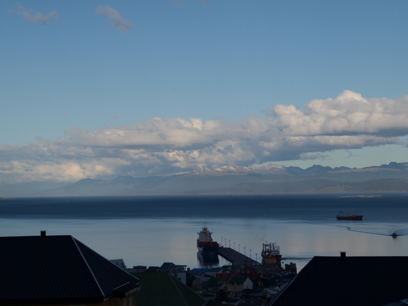
With the mountain at the backdrop and Bay of Beagle circulating the inlet, Ushuaia airport sits in the middle with the mountain reflecting in the water. The thought of the most southerly town with a spectacular image is what has lured visitors here for years.  Tourism industry is doing well.

Walking up the hilly Ushuaia, you could see the water with a simply magnificient view as Ushuaia is leaning on the hill.
Bay of Beagle in view from Ushuaia, Apr 2010.
Bridges Isles at Beagle Bay in Ushuaia, Apr 2010.

After heading back to the harbour, another forbidden face of Ushuaia is in view.
Ushuaia in Argentina, apr 2010.
It is this paradoxically figure that made it an attractive gateway for many.  Nowaday, other than the booming oil and gas industry, many retirees found refuge here in Ushuaia.

Take the boat tour, you will be sent to the Bridges Isles for a short hike.  From far at the Bridges Isles, it is the postcard look that every tourist took of Ushuaia.  If your lense is powerful, you can most likely took the photo from the boat when it is heading out from the harbour.  This is one I used many times.
Ushuaia in Argentina, Apr 2010.
Other than far being for its reputation of a pictureque town at the southernmost tip of our land, one thing undoubtedly you will find in Tierra del Fuege while Ushuaia is, it is the Calmest place on earth!

April 18, 2012

South America - Argentina Tierra del Fuego, the Ona calling

The Ona, southern Selk'nam Indians (also known as Yaghan or Yamana), came to Tierra del Fuego 10,000 years ago despite the icy Antarctica weather.  When Magellan first passing the island in 1520, he named this isolated land as Tierra del Fuego, Land of Fire. Today, as the southernmost province for both Argentina and Chile, there are hardly any indigenous Ona left where they survived for centuries. Sadly, it was not the brutal fault of nature.

Satio showed up at 8am with Pepe, the temperature was 7 degree celcius and we were heading to the Parque Nacional Tierra del Fuego. Along the way, we had 8 others with us so Satio became the peddling partner of mine.  The national park was a lumbering ground before till 1960. Thus, when we hiked the ground, we can see that the trees are young with the root quite surface to the ground.  The timber industry had wiped out any possibility for aging tree here. Harder more, the wind is so strong that the guide told us the forest renew itself because the wind storm would tow away trees almost every decade. We could see all the trees bent diagonally 45 degree due to the strong wind.
 
Nacional Parque Tierra del Fuego, Apr 2010.
The trees are well trimmed by the Patagonia wind, making it look like the gigantic "bonsai".
The park is more than beautiful.  I would rather use the word - Serene - due to its geographical location and nature.  Looking out to the shore, we saw the bay of another island across belongs to Chile.  It is so close, yet far!
Nacional Parque Tierra del Fuego, Apr 2010.
I have never been a place in the world where Peace is a norm, especially in the great wilderness.  I couldn't describe more because it is all about feeling.  It feels, deserted but not, soliture but not, loneliness but not, just Peacefully there and give that Sense of Contentment.

Start from Bahia Ensenada, the path was wind around thorny bushes and tough shrubs.  The ground was full of spongy moss on the stepping stones. We hiked 7KM along the coastline of Beagle Canal, in between Argentina and Chile waterway, and reach Lake Boca for our lamb stew lunch afternoon. The activity after the hiking was canoeing across Bay of Beagle. With the best peddling partner Satio, my canoe has no issue safely advancing. While the spanish couple, Juan and Suzana, when Juan jokes that he needs to divorce his wife during his honey moon,  we saw 6 sea lions swimming toward us.
Nacional Parque Tierra del Fuego, Apr 2010.
The 6 sea lions end up swimming along with our canoes till the end, flipping and splashing the ozing cool water at us. It was a wonderful moment! They are so playful, Satio said they are very used to human and they like to play. Satio seems to know them since he is in this national park at least twice a week.

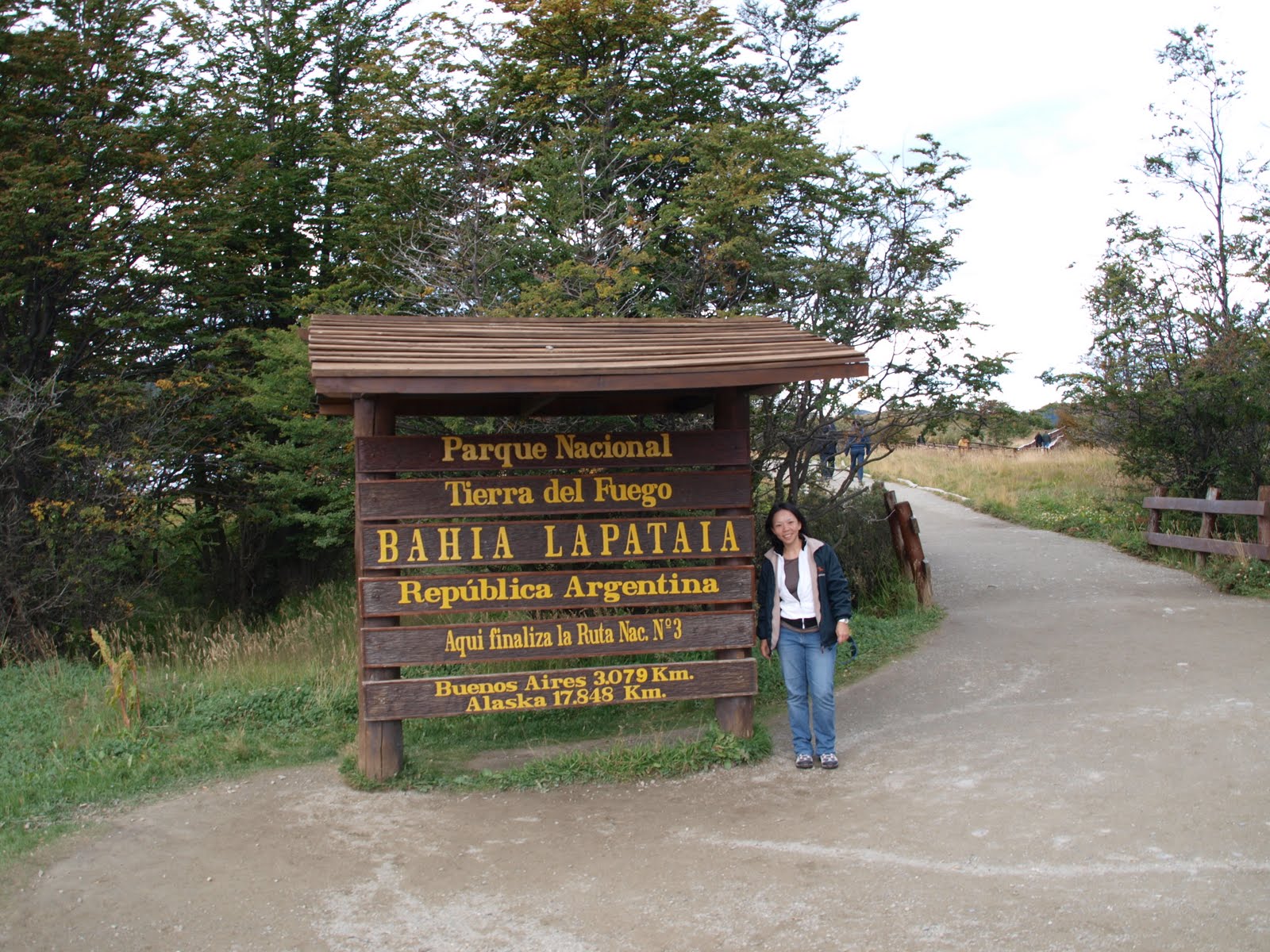
We arrived at Bahia Lapataia, after close to 2 hours in the water. Bahia Lapataia is the end of the Argentina RN3 and the end of the Pan-American highway from north to south of 17,848KM. That is why it is the End of the World. Here, it is 3000KM from Buenos Aires and 3000KM from South Pole.
Nacional Parque Tierra del Fuego, Apr 2010.
We leaved the park and headed back to Ushuaia. I really had an amazing time. After saying good bye to Pepe and Satio, it was tough to leave a day like that behind when the contentment is filled!